

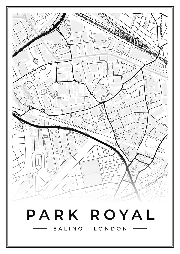
Park Royal Street Map Poster
From £14.95
View sizes & finishesREAL PLACES. YOUR ARTWORK.
Tell us a place that matters. Make it yours. Street map posters of Park Royal, drawn from OpenStreetMap, as posters, canvases and framed prints.
Posters from £14.95 · Free UK standard delivery
Browse ready-made Park Royal prints ↓Create your own Park Royal print →See your preview before you pay.

2 designs

From our own wall
Our founder’s Tilehurst Water Tower print, photographed at home. An earlier sample; current sizes and finishes are shown on each product page.
Their home town, a favourite holiday or the place where you met. Make a print of Park Royal with a photograph and a message from you.
Make their Park Royal print →Shop the local collection →Search our place photographs or upload your own. Keep the photograph or choose an illustrated look, then add your words.
Create your own Park Royal print →Photo to Poster
Pick one of our checked photographs of Park Royal, or upload your own: the street you grew up on, the view from your window, the church where you married. Choose a style, add a name, a date or a few words, and see your poster in a minute or two.
16 styles, from Retro Railway and Art Deco to English Watercolour, Linocut and Moonlit.
Turn a photo of Park Royal into artStyles are drawn by AI from the real photograph and checked against it, so your poster stays true to the place.
Our street map of Park Royal is drawn from OpenStreetMap, about 2.2 km across with north at the top. It takes in Acton Main Line on the West Coast Main Line, Low Level Goods and DC Electric Lines. The water on it includes Grand Union Canal (Paddington Arm), River Brent, Wembley Brook, Grand Union Canal (Paddington Branch) and Brent Canal Feeder. Green spaces include Stonebridge Recreation Ground, Heather Park Open Space, North Acton Playing Fields and Wesley Playing Fields. Main roads include Western Avenue, Hanger Lane, Park Royal Road, Victoria Road, Acton Lane and Ealing Road. It marks places of worship such as Seventh Day Adventist Church, St Mary's West Twyford, Catholic Church of the Holy Family and St. Gabriel's.
Mark your street, your first home or the place you met. Choose the colours and add a personal message.
Create your Park Royal street map →Park Royal is an area of London in the London Boroughs of Brent and Ealing, England.
Our Park Royal prints are two street map posters drawn from OpenStreetMap: a clean street map of the area in black and grey, and a heritage-colour map of Park Royal and the streets around it. Both come as posters, canvases or framed wall art.
Facts from Wikidata, the free knowledge base.
Open any print to see its current sizes, finishes and exact price before you order.
UK standard delivery is free. See delivery details for current estimates.
Delivery & returnsRead our returns policy for the terms that apply to ready-made and personalised prints.
Full returns policy


